Highlighted Study: Flushing time for 13 coastal bays in northern gulf
Overview
Flushing time is a key transport timescale used to quantify water renewal in coastal bays. Rigorous flushing time estimates are lacking for most northern Gulf of Mexico bays. Here, we provide the first systematic estimates for 13 major coastal bays using 20 years (2000–2019) of Lagrangian particle-tracking simulations coupled with a reliable high-resolution 3D hydrodynamic model.
We tracked particles released six times per day for 20 years, totaling 43,800 releases for each bay. Long-term mean flushing times range from 15 days in Mobile Bay to 178 days in Upper Laguna Madre.
Key Findings
- Mean flushing times are on the order of months, even for low-inflow estuaries.
- Depending on freshwater inflow, controlling mechanism
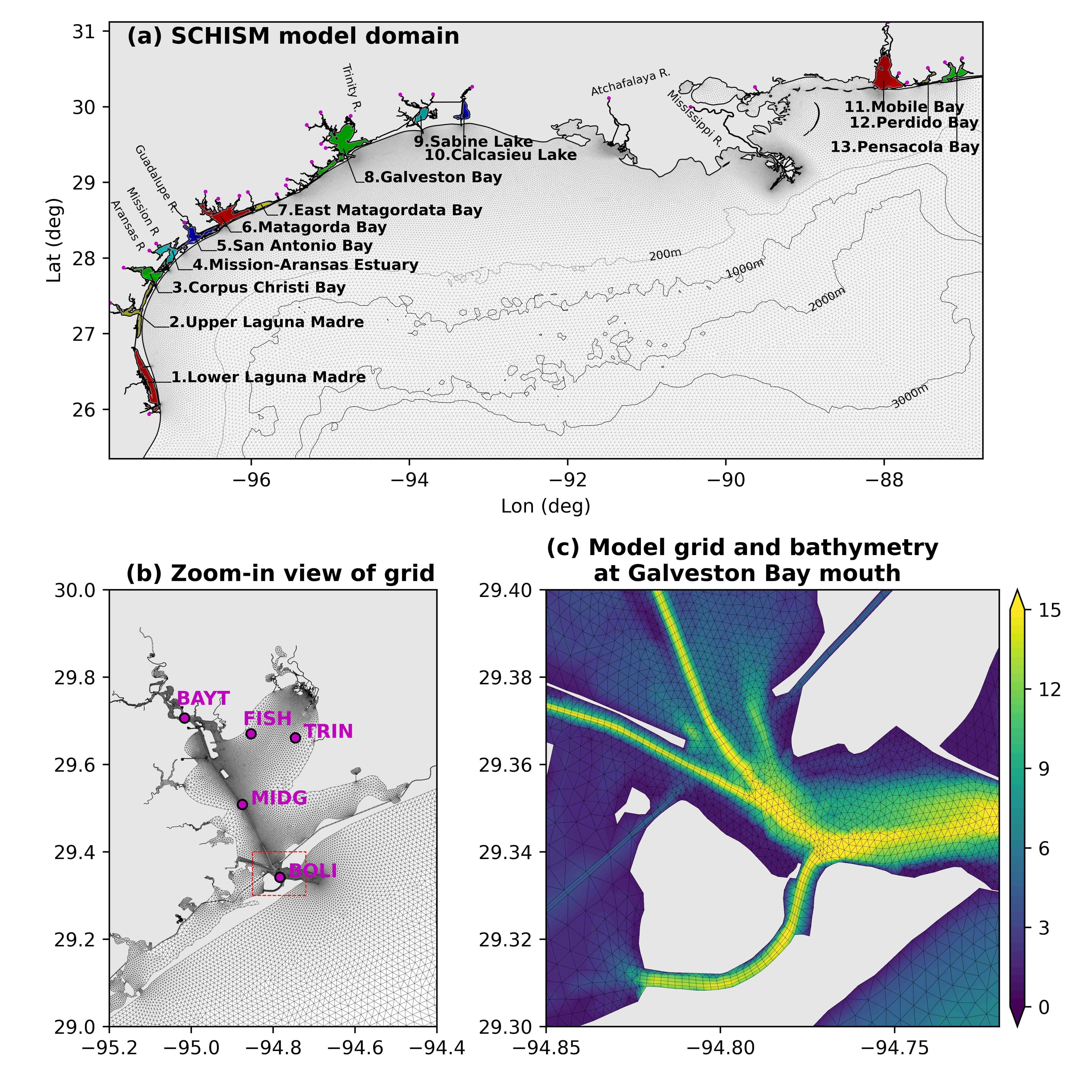 Figure 1: (a) Numerical model domain in the northern Gulf of Mexico and 13 major coastal bays considered in this study, (b) a zoom-in view of model grid in and near Galveston Bay, and (c) a zoom-in view of model grid and bathymetry at the Galveston Bay mouth. Also marked in (b) are five salinity monitoring stations maintained by the Texas Water Development Board.
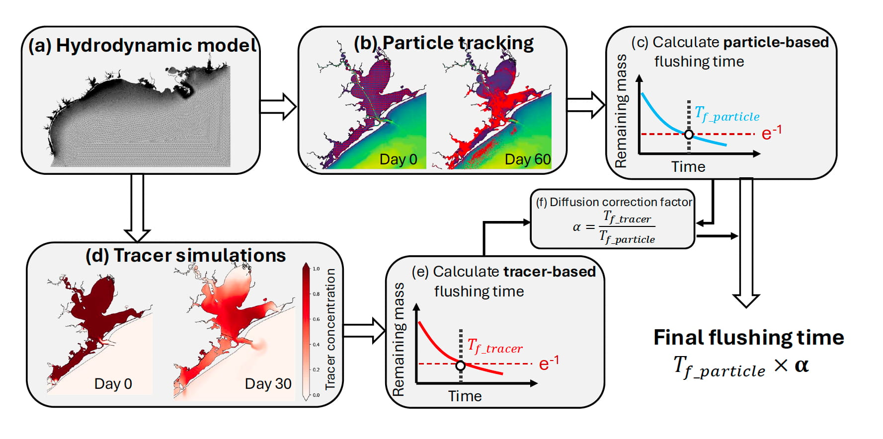 Figure 2: The overall methodology for flushing time calculation. The framework starts with the hydrodynamic model simulation (a) from which 2-hourly outputs are saved and used by an offline particle tracking model. Snapshots of particle location on days 0 and 60 for an example release for Galveston Bay (released at 00:00 UTC on January 31, 2018) are shown in (b). For each particle release, an e-folding flushing time (Tf_particle) is calculated (c). Another major component is tracer simulations, in which passive tracer within a bay is released at a certain time, with snapshots of tracer concentration on day 0 (2 hrs after release at 00:00 UTC on January 31, 2018) and day 30 are shown in (d) from which another flushing time (Tf_tracer) is calculated (e). Diffusion correction factor (α) is the ratio between Tf_tracer and Tf_particle (f), and the final flushing time is calculated based on Tf_particle and α.
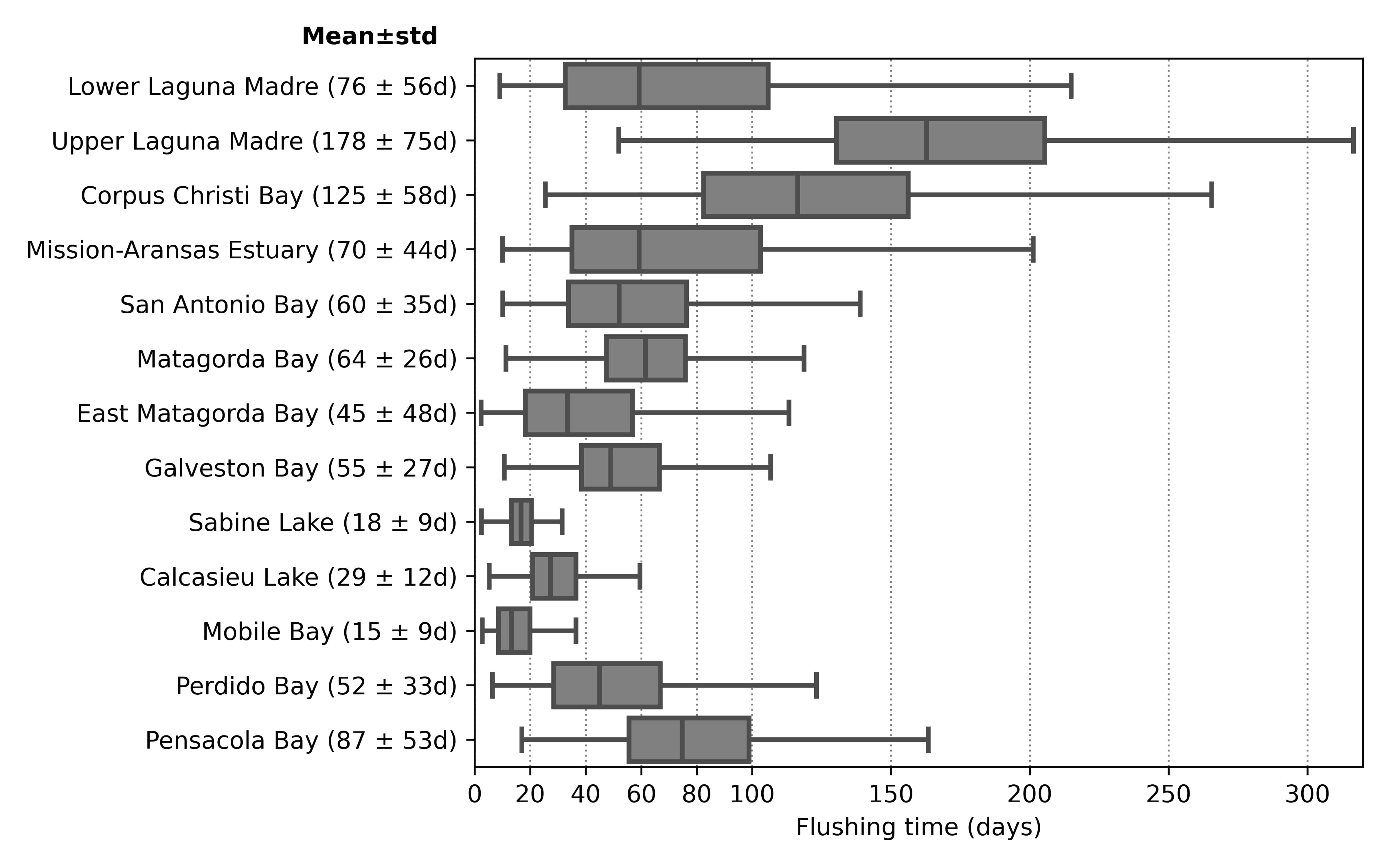 Figure 3: Estimated flushing times from the 10-day average data over the 20-year period (730 data points) for each of 13 major bays in the northern Gulf of Mexico, with the mean and standard deviation values shown in the parenthesis after the bay name. For each box plot, the shaded box shows the lower and upper quartiles as well as the median. The upper and lower limits indicate 95th and 5th percentiles, respectively.
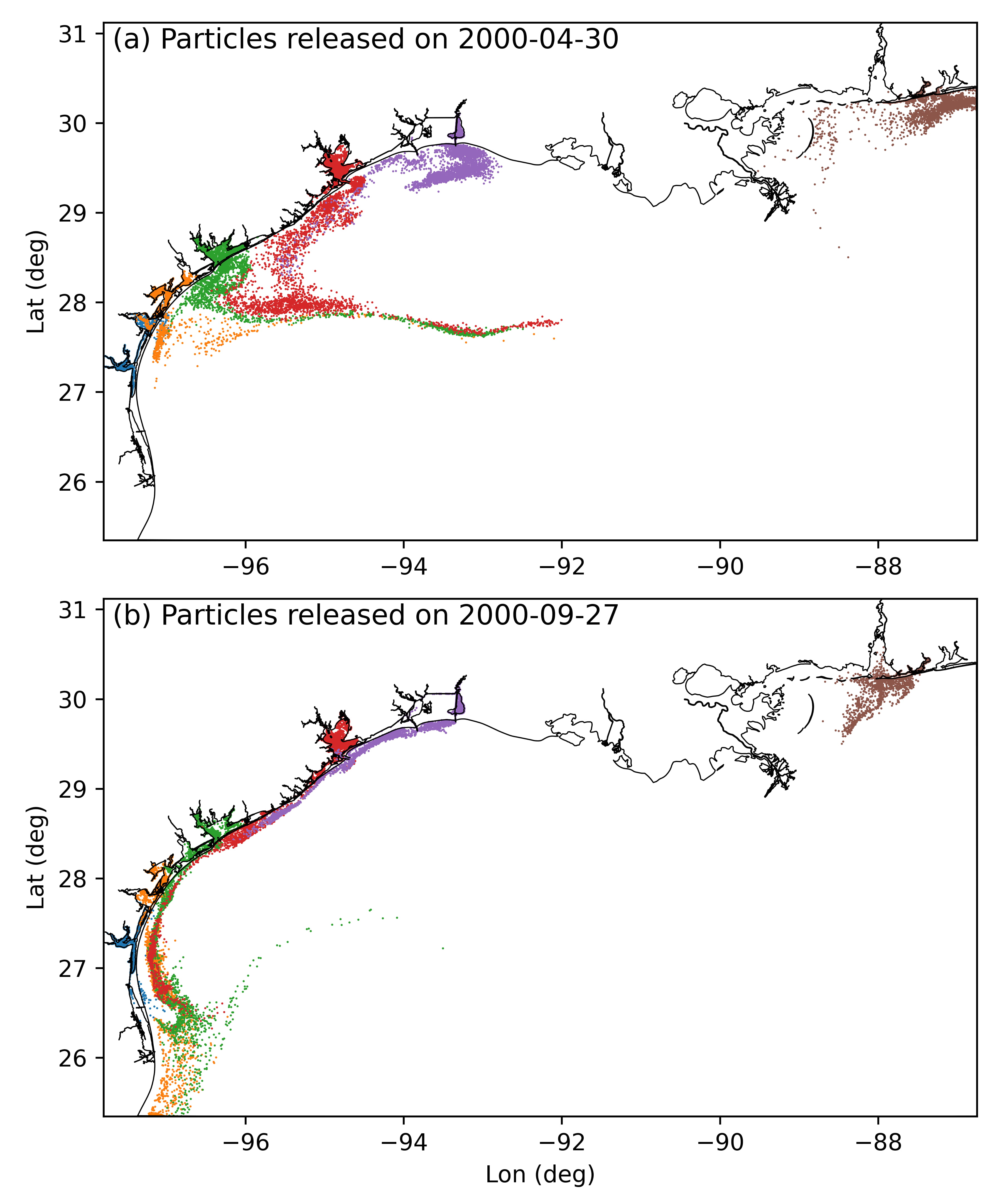 Figure 4: Distribution of particles 30 days after release for selected bays including Upper Laguna Madre (blue), Mission-Aransas Estuary (yellow), Matagorda Bay (green), Galveston Bay (red), Calcasieu Lake (purple), and Perdido Bay (brown).